
NORTH AMERICA GEOSPATIAL ANALYTICS MARKET FORECAST 2020-2028
North America Geospatial Analytics Market by Type (Surface Analysis, Network Analysis, Geovisualization, Other Type) by Technology (Remote Sensing, Global Positioning System (Gps), Geographic Information System (Gis), Other Technology) by Application (Surveying, Disaster Risk Reduction and Management, Medicine and Public Safety, Other Applications) by End User (Business, Utilities and Communication, Defense and Intelligence, Automotive, Government, Other End Users) by Geography.
The North America geospatial analytics market is growing rapidly and is anticipated to record a CAGR of 13.66% over the projected period of 2020-2028. The demand for geospatial analytics in the sectors of defense, intelligence, transportation, and logistics has contributed significantly to propelling the market growth in this region. The US spends the maximum in defense globally. The businesses have taken advantage of government investments in defense and booming technological innovations, leading to the emergence of commercial applications like GIS, GPS, and remote sensing technologies.
To know more about this report, request a free sample copy.
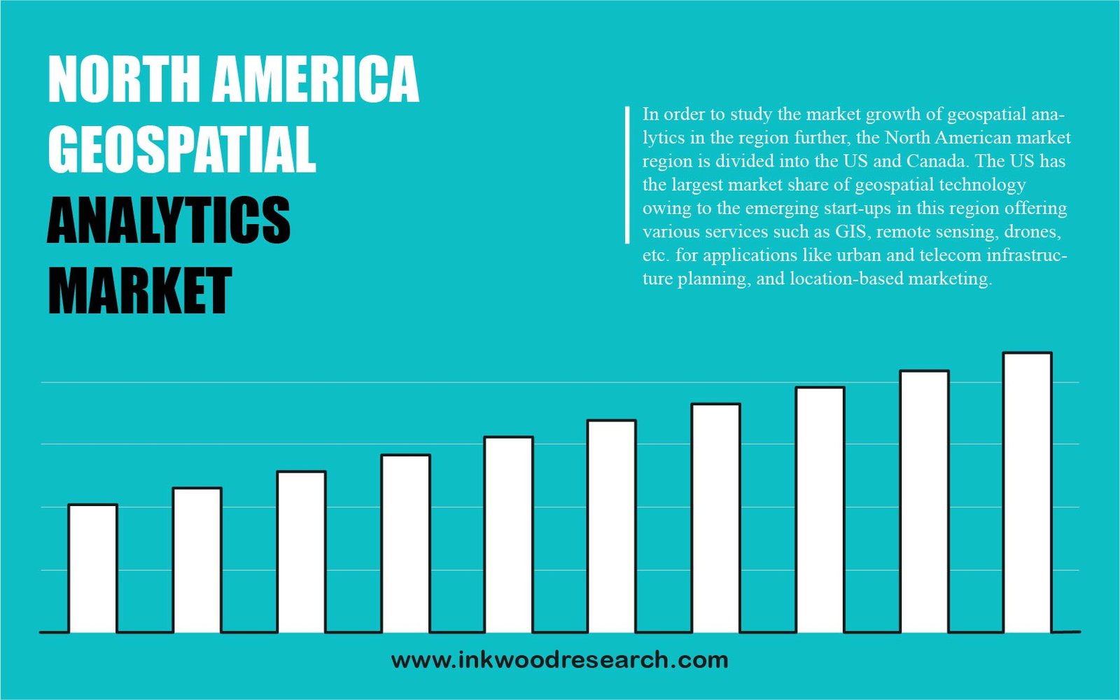
In order to study the market growth of geospatial analytics in the region further, the North American market region is divided into the US and Canada. The US has the largest market share of geospatial technology owing to the emerging start-ups in this region offering various services such as GIS, remote sensing, drones, etc. for applications like urban and telecom infrastructure planning, and location-based marketing. The market is also developing because of alliances and partnerships between companies. In the US, companies like Maxar, offers services such as ‘Spatial on-demand,’ the largest database of energy-specific online spatial information. It creates a live picture of possible exploration sites, and consolidates all the content in one place for data analysis. The market is also entering into the defense industry. Maritime geospatial analysis is being used by the US for remote sensing to identify threats such as illegal ship movement or fishing. There is an increase of 10% in the number of operational satellites from 2017.
Environmental Systems Research Institute, Inc., (ESRI), headquartered in Redlands, California, US, operates in Asia, Africa, North America, Europe, Oceania, and South America. The company announced a partnership with 3LOG Systems, the makers of a log inventory management solution.
To request a free sample copy of this report, please complete the form below :
We offer 10% free customization including country-level data, niche applications and competitive landscape with every report.
- RESEARCH SCOPE & METHODOLOGY
- STUDY OBJECTIVES
- SCOPE OF STUDY
- METHODOLOGY
- ASSUMPTIONS & LIMITATIONS
- EXECUTIVE SUMMARY
- MARKET SIZE & ESTIMATES
- MARKET OVERVIEW
- MARKET DYNAMICS
- MARKET DEFINITION
- KEY DRIVERS
- LATEST DEVELOPMENTS LEADING TO MERGING OF GEOSPATIAL PRACTICES
- INCREASED USAGE OF SPATIAL SERVICES IN NOVEL APPLICATIONS
- COMMERCIALIZATION OF GEOSPATIAL DATA
- KEY RESTRAINTS
- HUGE COSTS AND OPERATIONAL ISSUES
- LEGAL CONCERNS OVER GEOSPATIAL DATA
- KEY ANALYTICS
- KEY INVESTMENT INSIGHTS
- PORTER’S FIVE FORCE ANALYSIS
- BUYER POWER
- SUPPLIER POWER
- SUBSTITUTION
- NEW ENTRANTS
- INDUSTRY RIVALRY
- OPPORTUNITY MATRIX
- VENDOR LANDSCAPE
- KEY BUYING CRITERIA
- COST
- COMPANY BACKGROUND AND EXPERIENCE
- EASE OF USE
- MARKET BY TYPE
- SURFACE ANALYSIS
- NETWORK ANALYSIS
- GEOVISUALIZATION
- OTHER TYPE
- MARKET BY TECHNOLOGY
- REMOTE SENSING
- GLOBAL POSITIONING SYSTEM (GPS)
- GEOGRAPHIC INFORMATION SYSTEM (GIS)
- OTHER TECHNOLOGY
- MARKET BY APPLICATION
- SURVEYING
- DISASTER RISK REDUCTION AND MANAGEMENT
- MEDICINE AND PUBLIC SAFETY
- OTHER APPLICATIONS
- MARKET BY END USER
- BUSINESS
- UTILITIES AND COMMUNICATION
- DEFENSE AND INTELLIGENCE
- AUTOMOTIVE
- GOVERNMENT
- OTHER END USERS
- GEOGRAPHICAL ANALYSIS
- NORTH AMERICA
- UNITED STATES
- CANADA
- NORTH AMERICA
- COMPANY PROFILES
- ESRI
- MDA CORPORATION (MAXAR TECHNOLOGIES LTD)
- HEXAGON AB
- TRIMBLE INC.
- BENTLEY SYSTEMS INC.
- FUGRO N.V.
- HARRIS CORPORATION
- ATKINS PLC
- GENERAL ELECTRIC COMPANY
- CRITIGEN LLC
- INTERMAP TECHNOLOGIES INC.
- PITNEY BOWES
- FUGRO N.V.
- ALTERYX INC.
- GOOGLE INC.
LIST OF TABLES
TABLE 1: MARKET SNAPSHOT – GEOSPATIAL ANALYTICS
TABLE 2: NORTH AMERICA GEOSPATIAL ANALYTICS MARKET, BY TYPE, HISTORICAL YEARS, 2016-2019 (IN $ BILLION)
TABLE 3: NORTH AMERICA GEOSPATIAL ANALYTICS MARKET, BY TYPE, FORECAST YEARS, 2020-2028 (IN $ BILLION)
TABLE 4: NORTH AMERICA GEOSPATIAL ANALYTICS MARKET, BY TECHNOLOGY, HISTORICAL YEARS, 2016-2019 (IN $ BILLION)
TABLE 5: NORTH AMERICA GEOSPATIAL ANALYTICS MARKET, BY TECHNOLOGY, FORECAST YEARS, 2020-2028 (IN $ BILLION)
TABLE 6: NORTH AMERICA GEOSPATIAL ANALYTICS MARKET, BY APPLICATION, HISTORICAL YEARS, 2016-2019 (IN $ BILLION)
TABLE 7: NORTH AMERICA GEOSPATIAL ANALYTICS MARKET, BY APPLICATION, FORECAST YEARS, 2020-2028 (IN $ BILLION)
TABLE 8: NORTH AMERICA GEOSPATIAL ANALYTICS MARKET, BY END USER, HISTORICAL YEARS, 2016-2019 (IN $ BILLION)
TABLE 9: NORTH AMERICA GEOSPATIAL ANALYTICS MARKET, BY END USER, FORECAST YEARS, 2020-2028 (IN $ BILLION)
TABLE 10: NORTH AMERICA GEOSPATIAL ANALYTICS MARKET, BY COUNTRY, HISTORICAL YEARS, 2016-2019 (IN $ BILLION)
TABLE 11: NORTH AMERICA GEOSPATIAL ANALYTICS MARKET, BY COUNTRY, FORECAST YEARS, 2020-2028 (IN $ BILLION)
LIST OF FIGURES
FIGURE 1: KEY INVESTMENT INSIGHTS
FIGURE 2: PORTER’S FIVE FORCE ANALYSIS
FIGURE 3: OPPORTUNITY MATRIX
FIGURE 4: VENDOR LANDSCAPE
FIGURE 5: KEY BUYING CRITERIA
FIGURE 6: NORTH AMERICA GEOSPATIAL ANALYTICS MARKET, GROWTH POTENTIAL, BY TYPE, IN 2019
FIGURE 7: NORTH AMERICA GEOSPATIAL ANALYTICS MARKET, SURFACE ANALYSIS, 2020-2028 (IN $ BILLION)
FIGURE 8: NORTH AMERICA GEOSPATIAL ANALYTICS MARKET, NETWORK ANALYSIS, 2020-2028 (IN $ BILLION)
FIGURE 9: NORTH AMERICA GEOSPATIAL ANALYTICS MARKET, GEOVISUALIZATION, 2020-2028 (IN $ BILLION)
FIGURE 10: NORTH AMERICA GEOSPATIAL ANALYTICS MARKET, OTHER TYPE, 2020-2028 (IN $ BILLION)
FIGURE 11: NORTH AMERICA GEOSPATIAL ANALYTICS MARKET, GROWTH POTENTIAL, BY TECHNOLOGY, IN 2019
FIGURE 12: NORTH AMERICA GEOSPATIAL ANALYTICS MARKET, BY REMOTE SENSING, 2020-2028 (IN $ BILLION)
FIGURE 13: NORTH AMERICA GEOSPATIAL ANALYTICS MARKET, BY GLOBAL POSITIONING SYSTEM (GPS), 2020-2028 (IN $ BILLION)
FIGURE 14: NORTH AMERICA GEOSPATIAL ANALYTICS MARKET, BY GEOGRAPHIC INFORMATION SYSTEM (GIS), 2020-2028 (IN $ BILLION)
FIGURE 15: NORTH AMERICA GEOSPATIAL ANALYTICS MARKET, BY OTHER TECHNOLOGIES, 2020-2028 (IN $ BILLION)
FIGURE 16: NORTH AMERICA GEOSPATIAL ANALYTICS MARKET, GROWTH POTENTIAL, BY APPLICATION, IN 2019
FIGURE 17: NORTH AMERICA GEOSPATIAL ANALYTICS MARKET, BY SURVEYING, 2020-2028 (IN $ BILLION)
FIGURE 18: NORTH AMERICA GEOSPATIAL ANALYTICS MARKET, DISASTER RISK REDUCTION, AND MANAGEMENT, 2020-2028 (IN $ BILLION)
FIGURE 19: NORTH AMERICA GEOSPATIAL ANALYTICS MARKET, MEDICINE, AND PUBLIC SAFETY, 2020-2028 (IN $ BILLION)
FIGURE 20: NORTH AMERICA GEOSPATIAL ANALYTICS MARKET, BY OTHER APPLICATIONS, 2020-2028 (IN $ BILLION)
FIGURE 21: NORTH AMERICA GEOSPATIAL ANALYTICS MARKET, GROWTH POTENTIAL, BY END USER, IN 2019
FIGURE 22: NORTH AMERICA GEOSPATIAL ANALYTICS MARKET, BUSINESS, 2020-2028 (IN $ BILLION)
FIGURE 23: NORTH AMERICA GEOSPATIAL ANALYTICS MARKET, UTILITIES AND COMMUNICATION, 2020-2028 (IN $ BILLION)
FIGURE 24: NORTH AMERICA GEOSPATIAL ANALYTICS MARKET, DEFENSE, AND INTELLIGENCE, 2020-2028 (IN $ BILLION)
FIGURE 25: NORTH AMERICA GEOSPATIAL ANALYTICS MARKET, BY AUTOMOTIVE, 2020-2028 (IN $ BILLION)
FIGURE 26: NORTH AMERICA GEOSPATIAL ANALYTICS MARKET, BY GOVERNMENT, 2020-2028 (IN $ BILLION)
FIGURE 27: NORTH AMERICA GEOSPATIAL ANALYTICS MARKET, OTHER END USERS, 2020-2028 (IN $ BILLION)
FIGURE 28: NORTH AMERICA GEOSPATIAL ANALYTICS MARKET, REGIONAL OUTLOOK, 2019 & 2028 (IN %)
FIGURE 29: UNITED STATES GEOSPATIAL ANALYTICS MARKET, 2020-2028 (IN $ BILLION)
FIGURE 30: CANADA GEOSPATIAL ANALYTICS MARKET, 2020-2028 (IN $ BILLION)
- GEOGRAPHICAL ANALYSIS
- NORTH AMERICA
- UNITED STATES
- CANADA
- NORTH AMERICA
- MARKET BY TYPE
- SURFACE ANALYSIS
- NETWORK ANALYSIS
- GEOVISUALIZATION
- OTHER TYPE
- MARKET BY TECHNOLOGY
- REMOTE SENSING
- GLOBAL POSITIONING SYSTEM (GPS)
- GEOGRAPHIC INFORMATION SYSTEM (GIS)
- OTHER TECHNOLOGY
- MARKET BY APPLICATION
- SURVEYING
- DISASTER RISK REDUCTION AND MANAGEMENT
- MEDICINE AND PUBLIC SAFETY
- OTHER APPLICATIONS
- MARKET BY END USER
- BUSINESS
- UTILITIES AND COMMUNICATION
- DEFENSE AND INTELLIGENCE
- AUTOMOTIVE
- GOVERNMENT
- OTHER END USERS
To request a free sample copy of this report, please complete the form below :
We offer 10% free customization including country-level data, niche applications and competitive landscape with every report.